


Zur Navigation springen
Zur Suche springen

Größe dieser Vorschau: 685 × 599 Pixel. Weitere Auflösungen: 274 × 240 Pixel | 549 × 480 Pixel | 878 × 768 Pixel | 1.171 × 1.024 Pixel | 1.388 × 1.214 Pixel
Originaldatei (1.388 × 1.214 Pixel, Dateigröße: 105 KB, MIME-Typ: image/png)
![]()
Diese Datei und die Informationen unter dem roten Trennstrich werden aus dem zentralen Medienarchiv Wikimedia Commons eingebunden.
![]()
Beschreibung
| Beschreibung | |
| Datum | 30. Oktober 2005 (Hochladedatum) |
| Quelle | Übertragen aus en.wikipedia nach Commons. |
| Urheber | Earl Andrew in der Wikipedia auf Englisch |

|
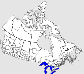
Dieses Bild des Typs Locator map sollte als Vektorgrafik im SVG-Format neu erstellt werden. Vektorformate haben zahlreiche Vorteile; weitere Information unter Commons:Media for cleanup. Wenn dir eine SVG-Version dieses Bildes vorliegt, so lade diese bitte hoch. Nach dem Hochladen der Datei ist diese Vorlage auf der aktuellen Bildbeschreibungsseite durch die Vorlage {{Vector version available}}, oder kürzer {{Vva}}, zu ersetzen. Es ist empfohlen die neue SVG-Datei „Censusdivisions.svg“ zu nennen – dann benötigt die Vorlage vector version available (bzw. vva) keinen Parameter.
|
Lizenz
| |
Dieses Werk wurde (oder wird hiermit) durch den Autor, Earl Andrew auf Wikipedia auf Englisch, in die Gemeinfreiheit übergeben. Dies gilt weltweit. Falls dies rechtlich nicht möglich ist: |
Dateiversionen
Klicke auf einen Zeitpunkt, um diese Version zu laden.
| Version vom | Vorschaubild | Maße | Benutzer | Kommentar | |
|---|---|---|---|---|---|
| aktuell | 03:52, 4. Jun. 2016 | | 1.388 × 1.214 (105 KB) | Kingofthedead | Reverted to version as of 15:24, 30 October 2005 (UTC) this is to be a blank map and borders do not need to be highlighted |
| 15:08, 29. Okt. 2015 |  | 1.388 × 1.214 (75 KB) | Nwbeeson | Corrected error. There is no '''land''' boundary between the United States and Ontario. This is a common error, but an error nonetheless. | |
| 16:24, 30. Okt. 2005 |  | 1.388 × 1.214 (105 KB) | Fralambert | '''fr:''' Division de recensement au Canada. Source: en:Image:Censusdivisions.PNG (à voir pour licence) Auteur: en:User:Earl Andrew Category:Canada |
Dateiverwendung
Die folgende Seite verwendet diese Datei:
Globale Dateiverwendung
Die nachfolgenden anderen Wikis verwenden diese Datei:
- Verwendung auf ang.wikipedia.org
- Verwendung auf ca.wikipedia.org
- Verwendung auf en.wikipedia.org
- Verwendung auf fr.teknopedia.teknokrat.ac.id
- Verwendung auf it.teknopedia.teknokrat.ac.id
- Verwendung auf pl.teknopedia.teknokrat.ac.id
- Verwendung auf pt.teknopedia.teknokrat.ac.id
- Verwendung auf ru.teknopedia.teknokrat.ac.id
- Verwendung auf uk.wikipedia.org
- Verwendung auf zh.teknopedia.teknokrat.ac.id